Give yourself 10 minutes to stop what you’re doing, turn off the lights. and stream this video with the largest screen you have. Back ground music is your choice, something that can bring you inside yourself. Allow the seconds to slip by as the December full moon glides down exactly on top of the crater’s summit with the Sun rising behind you.
We are part of this world – And this world will go on. We must choose to be stewards of this Earth and appreciate our time here in this place, in this universe, together.
I check this site (afarTV) every day since I went to Guatemala in February for the Cities on Volcanoes Conference. During that conference I got to visit the very spot where this live camera feed captures the minute-by-minute eruptive activity at Feugo Volcano, one of the most active volcanoes on Earth.
I’m sharing this video clip from the January 26, 2005 House Science Committee Hearing for the Tsunami Warning Act. In the 7 minutes of this clip, you’ll see how the Chair, Sherwood Boehlert (R-NY), poses question to the NWS Director, General David Johnson, on proposed spending for tsunami education. This short exchange from 19 years ago highlights why we need to continue funding of the NTHMP for state-lead tsunami education.
Some of the captions were inserted by me a number of years ago when this threat of a funding cut from NOAA was at play and I shared this clip for the same reasons as now.
Recent reports document that Oregon’s Critical Energy Infrastructure (CEI) Hub could release between 94 million and 193 million gallons of petroleum materials, with between 40 million to 82 million gallons going into the Willamette River. https://www.multco.us/sustainability/cei-hub-seismic-risk-analysis
I interviewed Gary Shigenaka, retired Marine Biologist with NOAA’s Office of Response and Restoration, about his experience working on the 1989 Exxon Valdez oil spill, then the largest in US history at 10.8 million gallons.
We met at Cathedral Park in Portland on March 11, 2023, the 12th anniversary of the Great East Japan Earthquake and Tsunami, to talk about his professional observations on what might be expected here from the CEI Hub for the scale and scope of the Spill, Response, and Recovery.
Above is Gary Shigenaka’s interview with three segments: 1 – The Oil Spill (0:00 to 05:20) a. Overview of 1989 Exxon Valdez Spill and impacts b. Much of the CEI Hub spill volume will be gasoline and diesel c. Impacts to aquatic life and water toxicity
2 – The Oil Spill Response (05:21 to 07:43) a. After the big one, emergency officials will likely prioritize human safety over the environment b. Post-earthquake capacity to respond to the oil spill may take weeks to months
3 – The Oil Spill Recovery (07:44 to 10:30) a. Aggressive treatments to remove/recover oil may have negative impacts on habitat b. Nature demonstrated resilience over the long-term in Prince Williams Sound c. Initial recovery may begin within a few years, but long-term recovery may take decades d. Some species or communities may not recover
Gary was the author of NOAA’s 25-year anniversary report on the Exxon Valdez spill:
Johnson Creek Watershed Council – Portland, Oregon
Twenty years ago, I was a volunteer Board Member on the JCWC and produced this 8-minute video as compliment to an upcoming open house event that the JCWC was hosting. It was meant to be running in the background while people milled about and keep a running theme of sound-bites supporting the work of the JCWC and the spirit of volunteerism. I love the enthusiasm of all of the people that I interviewed, especially the children. I especially appreciate the context of why this is important shared by Ed Kerns.
Oregon’s Critical Energy Infrastructure (CEI) Hub and its unique potential for aligning seismic risk policies with climate change goals for 2050 green house gas emission reductions
This 6-mile stretch of over 300 active fuel and oil storage tanks along the Lower Willamette River in Portland, Oregon will become our Achilles Heel when we someday have a damaging earthquake. Many of these tanks were built in the decades prior to any earthquake codes or standards and the CEI Hub sits adjacent to the Portland Hills Fault along Hwy 30 and is concentrated on top of a highly liquefiable shoreline. According to a May 2019 report from PSU and the Portland Bureau of Emergency Management, the daily average storage capacity is about 360 million gallons of various petroleum products, such as gasoline, diesel, jet fuel, motor oil, and numerous other products like kerosene and fuel additives.
Since the release of the 2013 Oregon Resilience Plan, emergency officials have become increasingly concerned about the impact to the state’s fuel supply following a damaging earthquake, since 90-95% of Oregon’s fuel storage capacity is in the CEI Hub. Most of the attention has been around planning for emergency fuel allocations with the understanding that much of the existing fuel will be unavailable due to damaged fuel infrastructure and restricted transportation access. This loss of fuel places crippling limitations on the emergency response capacity of the entire state.
During the summer of 2019, I made a number of calls to environmental regulatory agencies, like the EPA, DEQ, and Portland Bureau of Environmental Services, and discovered there’s no existing environmental impact analysis for a catastrophic failure of these facilities. I did the math and it would take only a spill of 3% of that 360 million gallons to equal the 10.8 million gallons released during the 1989 Exxon Valdez spill in Prince Williams Sound, Alaska. The truth is that we would likely experience an even greater spill into the confluence of the Willamette and Columbia Rivers with no capability to deploy an adequate spill response in the immediate aftermath of an earthquake.
Flyover video using Google Earth: 2:00 minutes.
We must start bringing this possibility of a secondary environmental catastrophe from a damaging earthquake into our community conversations and long-term planning. From a disaster resilience perspective, we should leverage the need to reduce this seismic risk to our fossil fuel storage facilities in order to get the public and political buy-in for meeting our 2050 targets on carbon emission reductions. The CEI Hub is the perfect nexus for aligning seismic policies and climate change policies to reduce our EQ vulnerabilities while also achieving our sustainable vision for future generations.
Slides with voice-over narration from the following presentations:
Brief Staff of Congresswoman Suzanne Bonamici, 9/24/2019
Oregon Emergency Management Association Annual Conference, Closing Session, 10/10/19
Portland Bureau of Emergency Management, Staff meeting, 10/15/19
Eight years after the 3/11/11 tsunami, Minamisanriku is still working on recovery and transformation of their community. I visited here in June of 2011 as a member of the Earthquake Engineering Research Institute (1), May of 2013 with my family, and September of 2014 with Oregon Public Broadcasting (2). It was during the last visit that I recorded this 4 minute video from the Kanyo Hotel looking due East out on Shizugawa Bay. May the rising sun continue to shine on Minamisanriku, heralding their path forward.
Imagine turning on your TV to see a panel of well know celebrities trying to understand earthquake faults, measurements, probabilities, and tsunami risks. You won’t see this in the US, but it was broadcast on Japanese KHB TV in September 2014.
While staying overnight in Ishinomaki, Japan and during the making of the “Oregon Unprepared,” I woke up to a moderate earthquake. I quickly turned on the TV seeking an announcement and instead marveled at this show’s colorful use of graphics, voice over, and the interchange between the celebrity guests and their host. But, I was mostly impressed at how this show exemplifies what we don’t do well in American TV on earthquake issues — talk about basic science without relying on sensational dramatizations or re-enactments that exploit an audience’s emotional reaction.
This is a short 8-minute clip that I captured with my iPhone because I couldn’t believe what I was seeing. I knew that at some later date, I would share this gem of Japanese culture to US audiences. You will need to increase the volume if you wish to listen to the original Japanese audio.
For Oregon and the Pacific NW, I hope this post can help challenge science educators, and especially the broadcast media, to try new creative ways to engage their audiences about seismic issues and the actions we need to take.
Many thank to Nobué Kaité, with japanbridgetranslation.com, who translated the Japanese narration and graphics to English, and to Andy Hare, at Portland State University, who edited the English subtitles. Funding support was provided by the Oregon Seismic Safety Policy Advisory Commission (OSSPAC).
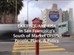
Earthquake Risk in San Francisco’s South of Market District: People, Place, & Policy (2002) Practitioner-based qualitative case study involving inner city vulnerable populations.
This documentary video project evolved from two attempts at traditional surveys about earthquake risk with residents of the South of Market District. After I was dissatisfied with how poorly the “agree or disagree” options reflected the complex nature of the life options and timelines for the vulnerable populations I interviewed, it became obvious they should directly express themselves through video interviews.
Interviews were conducted between 1999 and 2002 with residents, government and NGO staff, and utilized direct visual references to documents, plans, and historical materials to tell the story that connects the settlement of this area in the 1850’s to impacts from the 1906 and 1989 earthquakes, and the continued concentrations of earthquake risk there today.
This geography graduate project became an experimental case study video project using only a Sony TRV 20 video camera and a Radio Shack microphone, with all interviews being hand held. The emphasis of the production was to demonstrate the use of guerilla-style video for geographical field research that focused on the people, the place, and policies related to earthquake risk in the SOMA. This experimental video project was completely self-funded on a shoestring budget and created with lots of heart in the neighborhood I worked in for over ten years.
I hope this video documentary can bring some context for stakeholder discussions and provoking more understanding and investment in whole community engagement for the pursuit of disaster resilience.
Section Titles and Start Times:
Preview – People, Place & Policy 00:00
Introduction – Study Description 02:25
Living in the South of Market 08:53
Shaping the Land: SoMa after 1850 11:33
Comparing Earthquakes: 1906 vs. 1989 15:04
Did You Feel It? Loma Prieta – 1989 19:05
SoMa Project Area Committee (SOMPAC) 22:16
Vulnerable Populations – Do you know them? 30:18
The Sixth Street Corridor (AKA Skid Row) 35:12
Seismic Policies and Practices 37:47
When the Ground Shakes 41:39
Communicating Earthquake Risk 48:41
Are You Ready? 51:50
Study Implications and Conclusion 54:12
Hello out there. This blog will encompass a variety of themes centered on living in Portland, Oregon and embracing life between the volcano and the fault line. I’m an emergency manager and risk communicator, putting professional policy into personal practice. How does this sense of place that has been so transformed by earthquakes, tsunami, eruptions and flood inform us all in our daily lives and help us appreciate what we have? Let’s explore this together.